|
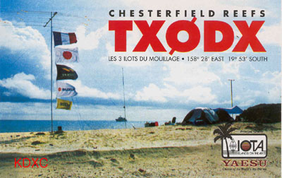
TX0DX
---> "The operation
went QRT on 29 March shortly
after 00.00 UTC. In six
days of operating, they
completed 72,654 QSOs. The
majority of QSOs were on
21 MHz SSB and CW, as per
the original strategy to
provide the maximum number
of DXers their first-ever
Chesterfield contact. However,
other complimentary bands
and modes were activated
sporadically, including
50 MHz with more than 2500
QSOs and RTTY with some
800 stations in the log.
On the way to the Chesterfields,
the TX0DX group made a slight
detour to the area where
intervening reefs are indicated
on some older maps. The
team was able to confirm
the French Navy's documentation
that the claimed islands
simply do not exist. Thus,
the 350-kilometer open water
separation between New Caledonia
and the Chesterfields is
assured, and the concerns
expressed by some in the
DX community can be put
to rest". <8
April 2000, No 466 425DX
NEWS>
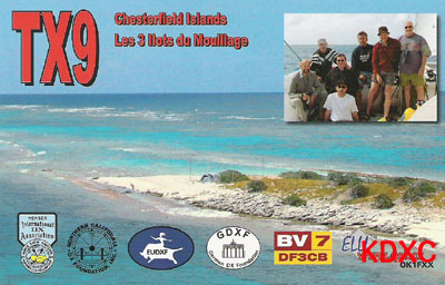
TX0DX
- CHESTERFIELD ISLANDS -
TX0DX hit the airwaves from
the Chesterfield Islands
at exactly 0000 UTC on 23
March. Regular bulletins
will be posted to the TX0DX
web site at http://www.n4gn.com/tx0dx/
throughout the operation.
The team has announced a
new operating plan for the
coming CQ WPX SSB contest
weekend. Rather than the
previously announced plan
to operate on 15 SSB [425DXN
463], TX0DX will concentrate
on 28.745 MHz SSB over the
weekend. Additional SSB
activity will take place
on 12 and 17 meters, while
normal CW activity will
continue on the other bands.
For QSL information see
below. <25 March
2000, No 464 425DX NEWS>
|